Unmanned Aircraft Navigation
TruNav personnel have developed new navigation solutions for Unmanned Aircraft Systems (UAS) that ensure safe navigation beyond line of sight.
- Detect and avoid integrity monitoring
- Continuity risk evaluations
- Certifiable safety requirements
- Onboard sensor integration
INS-Aided Fault Detection
TruNav engineers have exploited differential GNSS/INS tightly-coupled integration to enhance integrity and robustness of safety-critical navigation applications.
- Innovative fault detection algorithms
- Anti-spoofing capabilities
- Jamming resistance
- Certifiable architecture
Aircraft Precision Approach
TruNav engineers have developed advanced navigation algorithms for precision approach applications that involve safety-of-life.
- Ground Based Augmentation Systems (GBAS)
- FAA-sponsored research
- Multi-constellation Advanced RAIM
- Integrity monitoring algorithms
Relative Navigation
TruNav personnel have special expertise in differential code and carrier navigation for precise inter-vehicle positioning.
- Autonomous airborne refueling (AAR)
- Shipboard landing systems
- US Navy applications
- High accuracy & high integrity
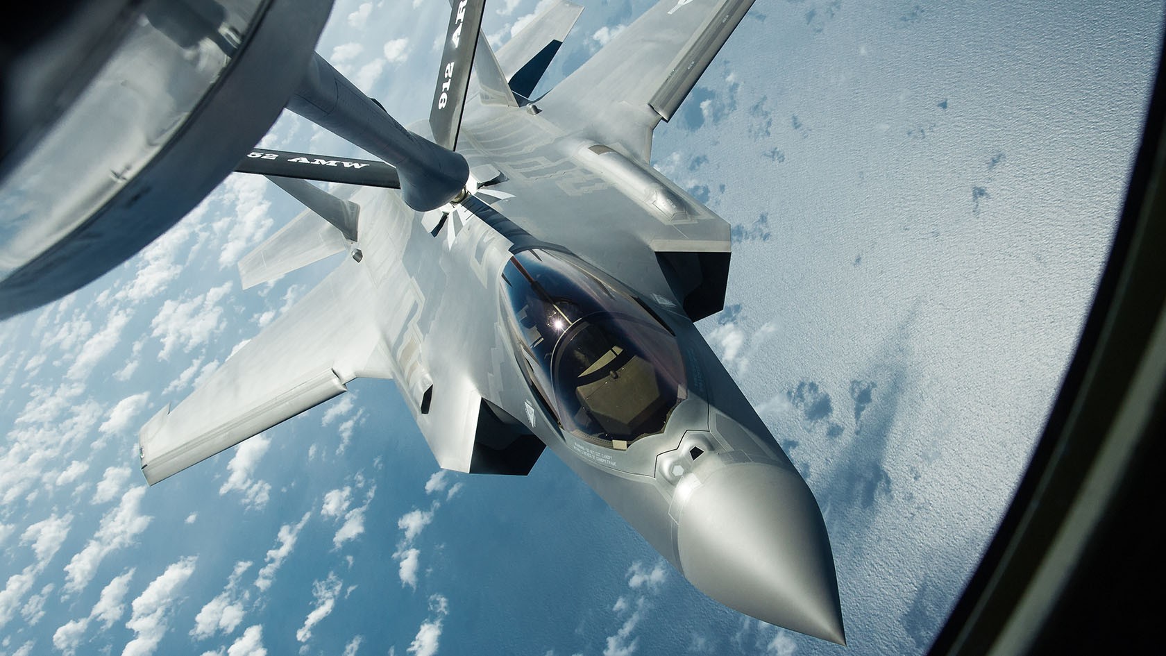
Autonomous Airborne Refueling
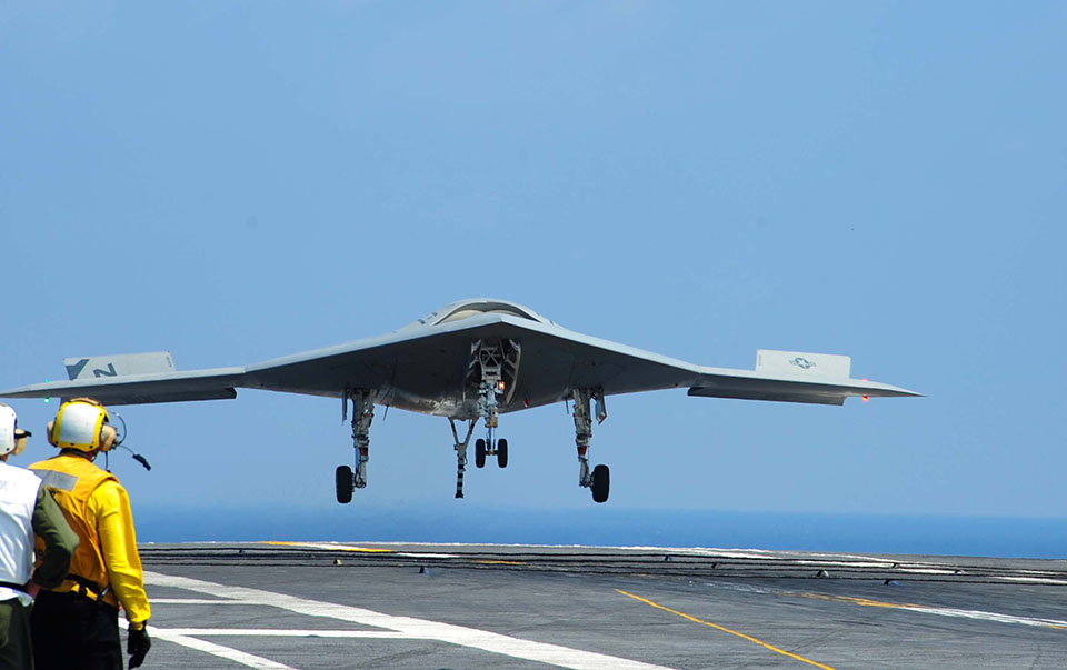
Autonomous Shipboard Landing

Autonomous Drone Operations
WAAS/CORS/RTK
TruNav develops seamless technology for network-based navigation exploiting Wide Area Augmentation Systems, Continuously Operating Reference Stations, and Real-Time Kinematic positioning.
- Network-based differential corrections
- CORS station integration
- Sub-centimeter accuracy
- Seamless multi-station fusion
Geotagging Applications
High-precision location tagging for professional surveying, mapping, and monitoring applications requiring centimeter-level accuracy.
- Professional surveying solutions
- High-resolution mapping
- Asset tracking and monitoring
- Geographic information systems (GIS)
Water Level Monitoring
Specialized systems for NOAA's National Water Level Observation Network service, monitoring water surfaces across the United States.
- Continuous water level measurement
- Tide and current monitoring
- Long-term stability
- Environmental data collection
Structural Monitoring
Continuous monitoring of infrastructure deformation and movement for bridges, dams, buildings, and other critical structures.
- Millimeter-level deformation detection
- Long-term stability monitoring
- Early warning systems
- Infrastructure health assessment

Continuously Operating Reference Station (CORS) Network Infrastructure
Autonomous Vehicles
Navigation and positioning solutions for connected and autonomous vehicles requiring high precision and reliability.
- Lane-level positioning accuracy
- Multi-sensor fusion
- Safety integrity monitoring
- V2X communication support
Railway Systems
Precision positioning and navigation solutions for railway applications, including train control and monitoring systems.
- Train positioning and tracking
- Positive train control (PTC)
- Track geometry measurement
- Safety-critical applications
Maritime Navigation
Advanced navigation systems for maritime applications, ensuring safe and efficient vessel operations.
- Port approach and docking
- Vessel traffic management
- Autonomous surface vessels
- Hydrographic surveying
Intelligent Transportation
Smart transportation solutions integrating GNSS with communication systems for improved traffic management and safety.
- Real-time traffic monitoring
- Fleet management systems
- Emergency response optimization
- Connected vehicle infrastructure

Precision Navigation for Railway Transportation Safety